Driving North East Victoria
Why drive the direct route when you can take the long way home
NORTH East Victoria - and parts of the Southern Riverina - showcase some of Australia's best driving routes, guiding you through diverse landscapes and breathtaking scenery that celebrate the very essence of the four seasons.
With hundreds of kilometres of enchanting highways, byways, and interesting back roads to explore, why not 'take the long way home.'

ALBURY-WODONGA based motoring writer, Darryl Starr, is thecountrydriver who, in a professional career spanning 60+ years, has driven over 3.5 million kilometres of Australian roads, primarily on the scenic roads of North East Victoria and the Southern Riverina. He has handpicked four driving gems for you to explore at your own pace, highlighted by the 300+km Great Alpine Road. So, what are you waiting for? Fill your tank/charge your battery and hit the road.

1: Great Alpine Road - the best of the best
ONE of the great road trips in Australia for your travel bucket list must be the Great Alpine Road.
It is up there with the best of them. In my eyes, it is the best of them, as it is a driver’s road that ‘comes with the lot’.
For the greater part of its 186 kilometres from Wangaratta to Omeo, the Great Alpine Road snakes across the top of Victoria’s High Country and through the picturesque Alpine National Park, rising in parts to 1840 metres above sea level, making it Australia’s highest year-round accessible sealed road.
State route B500 follows the course of the Ovens River from Wangaratta to Harrietville, before climbing out of the picturesque Ovens Valley, crossing the high plains, then dropping from Omeo to Bairnsdale, gateway to The Lakes National Park.
An extraordinary drive at any time of the year, the Great Alpine Road packs a powerful punch as far as scenery goes, as not only does it pass through Victoria’s largest national park - which boasts 10 of the 11 highest mountains in the state - it also traverses through valleys and forests, past fast-flowing rivers and crystal clear streams, and through quaint historic villages.
The Great Alpine Road, which has existed in some form or another since colonial times, was completed with the sealing of the section between Mount Hotham and Dinner Plain in 1998.
From its northern end at Wangaratta, the GAR travels through Tarrawingee, Everton and Gapsted to Myrtleford.
From Myrtleford the road passes along the Ovens Valley through Ovens, Eurobin, Porepunkah, the popular tourist destination of Bright, Freeburgh, Smoko and Harrietville, before starting the steep and windy climb to the alpine resort of Mount Hotham (the second highest village in the country), 32 kilometres further up the Great Dividing Range.
The 55 kilometres of road from Mount Hotham through Dinner Plain and Cobungra to Omeo is surprisingly flat.
Through the ‘off' seasons, services at Mount Hotham and Dinner Plain are limited.
From Omeo - a great base from which to explore the national parks and alpine surrounds - the GAR turns south, following the course of the Tambo River through the settlements of Tongio, Swifts Creek, Doctors Flat, Ensay, and Bruthen, before meeting the Princes Highway (A1) at Bairnsdale.
Caravanners do use the road but be aware that between Harrietville and Hotham Heights it is steep, narrow, and windy, with many hairpin bends. Chains must be carried in winter and fitted when and where directed.
Sections of the road are subject to closure during winter, and bushfires can close it in summer.
Fuel is not available between Bright and Omeo, and only limited supplies are available between Omeo and Bruthen.
Photo: Josie Withers
Distance Wangaratta to Bairnsdale: 304 kilometres

2: Great River Road - a blast along the Murray
THE Great River Road (formerly Murray River Road), is one of Australia’s great drivers' and riders’ roads. It is a cracker.
It snakes its way almost its entire 156-kilometre length from Albury-Wodonga to Corryong, following the course of the Murray River which separates the states of New South Wales and Victoria.
As the course of the river meanders through the Upper Murray, so too does the Great River Road, which starts to the east of Albury-Wodonga at the Bethanga Bridge which spans Lake Hume.
It passes through picturesque farming countryside and the rural communities of Burrowye, and Guys Forest and skirts the small village of Jingellic which sits on the New South Wales side of the river.
Walwa, the main town on the road before you reach Corryong, is close to Pine Mountain, the largest monolith in the southern hemisphere at 1.5 times the size of Uluru (Ayres Rock).
A further 29 kilometres east is the historic township of Tintaldra where you can glean some amazing views of the distant Snowy Mountains.
Before your drive (or ride) ends at Corryong, you pass through Towong, the western gateway to the Kosciusko National Park.
From Towong the Murray Valley Highway takes you to Corryong, the heart of The Man from Snowy River country.
The Great River Road is sealed for its entire length, does become narrow in parts, and is caravan friendly.
Photo: Towong Shire Council
Distance Albury to Corryong: 156 kilometres

3: Snowy Valleys Way - a back roads beauty
IF you are travelling between Melbourne and Sydney and you are not in a rush, there is an alternate route between Wangaratta and Gundagai - or vice versa - than driving the busy Hume Freeway.
It is called the Snowy Valleys Way, a magnificent drive any time of the year. It is not route numbered as it is made up of many different roads and highways.
It passes through towns that are etched in our history, such as the gold rush towns of Beechworth and Yackandandah, Tallangatta, the town that moved, and the Man from Snowy River town of Corryong.
The Snowy Valleys Way starts at historic Gundagai in New South Wales to the north and ends in Beechworth to the southwest (turn off the Hume Freeway at Wangaratta if travelling north from Melbourne).
This alternate, slow-paced network of roads allows the tourist or day tripper the opportunity to take in some of the country’s most breathtaking scenery, explore the many small towns, villages and hamlets along the way and sample country cuisine at the many hotels, cafes, bakeries and restaurants and sample delicate cool-climate wines at the many boutique wineries that are dotted along - and off - the route.
Other towns and villages along the way include Tarrawingee, Wooragee, Kiewa-Tangambalanga, Bullioh, Koetong, Shelley and Colac Colac.
If coming from Victoria, you cross the Murray River at Towong and head to the farming community of Tooma, which is 35 kilometres from Tumbarumba. Must stops along this section of road include the Southern Cloud aircraft disaster memorial, and Paddy River Falls.
Tumbarumba is known as a timber town owing to its heavy dependence on logging, Batlow is known for its apple orchards, while Tumut, which sits on the Snowy Mountains Highway, is the northern gateway to the Snowy Mountains.
Gundagai is famous for the Dog on the Tuckerbox monument, located 'five miles from Gundagai'.
The entire length of the Snowy Valleys Way is sealed and is caravan friendly but, remember, it is not signposted. For route maps, visit www.snowyvalleysway.com.au
Most of the roads are wide, but some of the interconnecting roads are narrow and some care needs to be taken.
Photo: Destination NSW
Distance Gundagai to Wangaratta: 363.6 kilometres

4: Alpine Way - if mountain roads are your thing
THE Alpine Way is a 121-kilometre, all-weather, fully sealed road located in the southeastern corner of the Southern Riverina.
Built in the 1950s as an access road for the construction of the Snowy Mountains Hydro Electric Scheme, the road skirts the southern and western slopes of the Kosciuszko National Park (fees and other conditions apply).
At information centres at Khancoban or Jindabyne, you can check road conditions, buy a pass, ask about camping grounds, magnificent walks, ski resorts, or where to capture that perfect photograph of Australia’s highest mountain – Mount Kosciuzsko (2228m).
The road is also a somewhat slower-paced alternative route from North East Victoria to the NSW snowfields of Thredbo, Charlotte Pass, Perisher, Smiggin Holes, Crackenback and Guthega.
As the road is steep, narrow, and winding between Khancoban and Thredbo, and subject to rock falls, it is not recommended for vehicles towing large caravans.
The Alpine Way crests the Great Dividing Range at Dead Horse Gap at an altitude of 1580m.
Road restrictions in the region require all vehicles to carry snow chains between June and October but, due to sudden weather changes, be prepared at any time of the year.
And that includes dressing appropriately.
Photo: Destination NSW
Distance Khancoban to Jindabyne - 121 kilometres
10 more 'must-do' North East Victoria drives
Granya (Gap) Road - Granya to Bullioh - 17.8km
Tawonga Gap Road - Bright to Mount Beauty - 31.7km
Lockharts Gap Road - Red Bluff to Tallandoon - 23.6km
Shelley Road - Walwa to Shelley - 32km
Benambra-Corryong Road - Corryong to Omeo - 143km
Omeo Highway - Tallangatta to Omeo - 165km
Whitfield-Mansfield Road - Whitfield to Mansfield - 60.8km
Euroa-Mansfield Road - Euroa to Merton - 32.5km
Bogong High Plains Road - Mount Beauty to Glen Valley - 67.7km
Happy Valley Road - Ovens to Running Creek - 34km
* Note: Some of these routes require chains to be carried and fitted where directed during winter months
** thecountrydriver defines North East Victoria as a region bounded by the Murray River to the north, the Victorian High Country to the south, the western slopes of the Snowy Mountains to the east, and bordered by the towns of Cobram, Euroa, and Mansfield to the west.
Local motoring history books
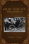
The Pioneer Motor Car Trip of Australia, 'Are we there yet, Mr Holmes?', and A Spirit of Progress - 110 years of motoring in Albury-Wodonga, are free-to-read online local motoring books. To view, click on the required cover and wait for the pdf to load.